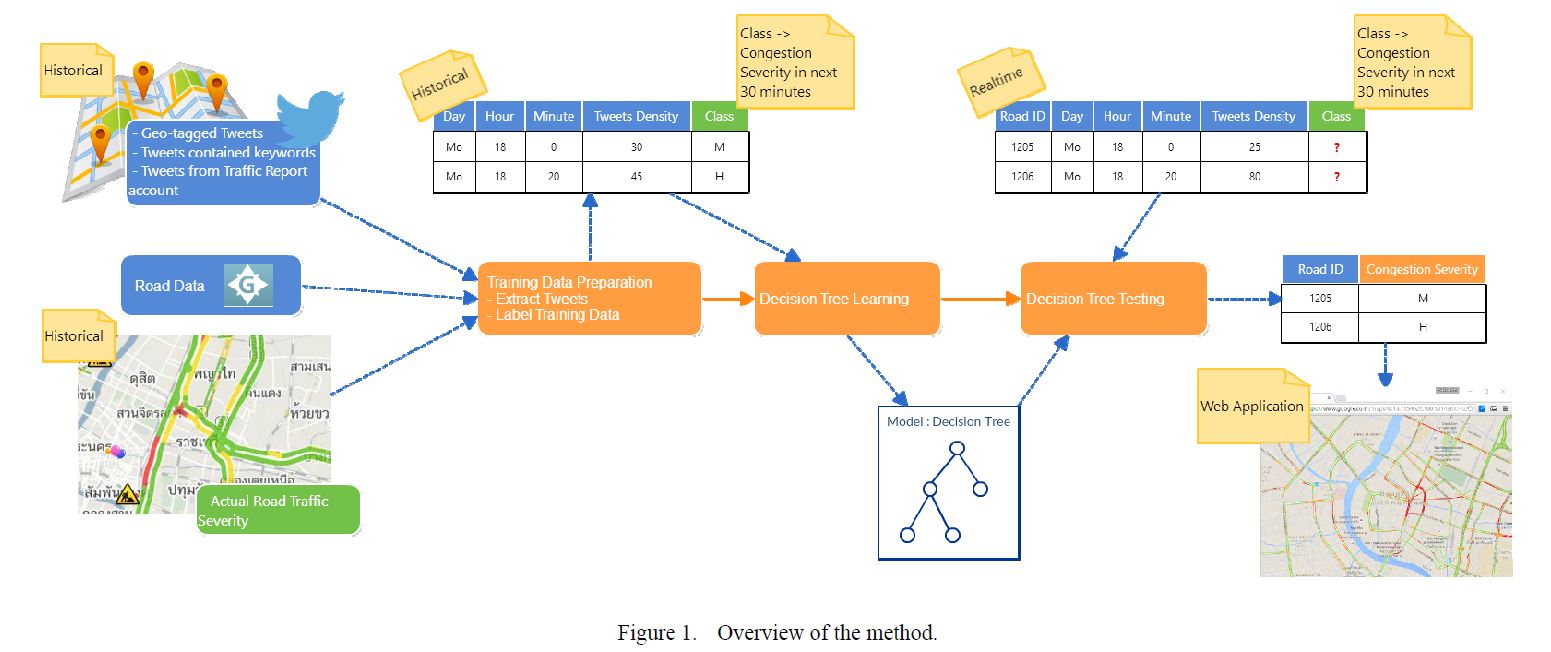
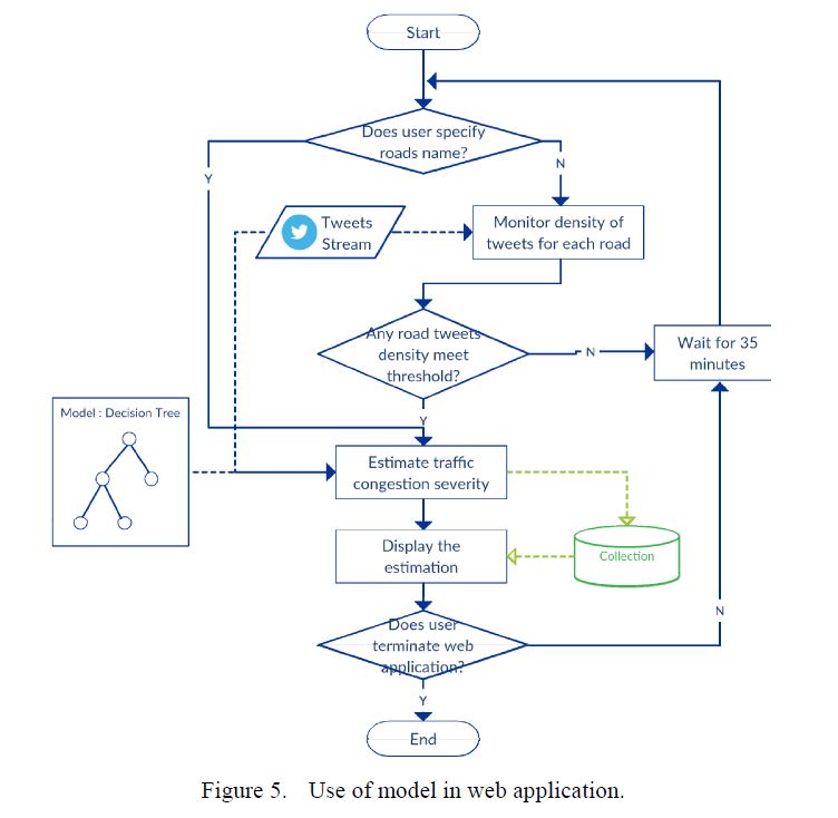
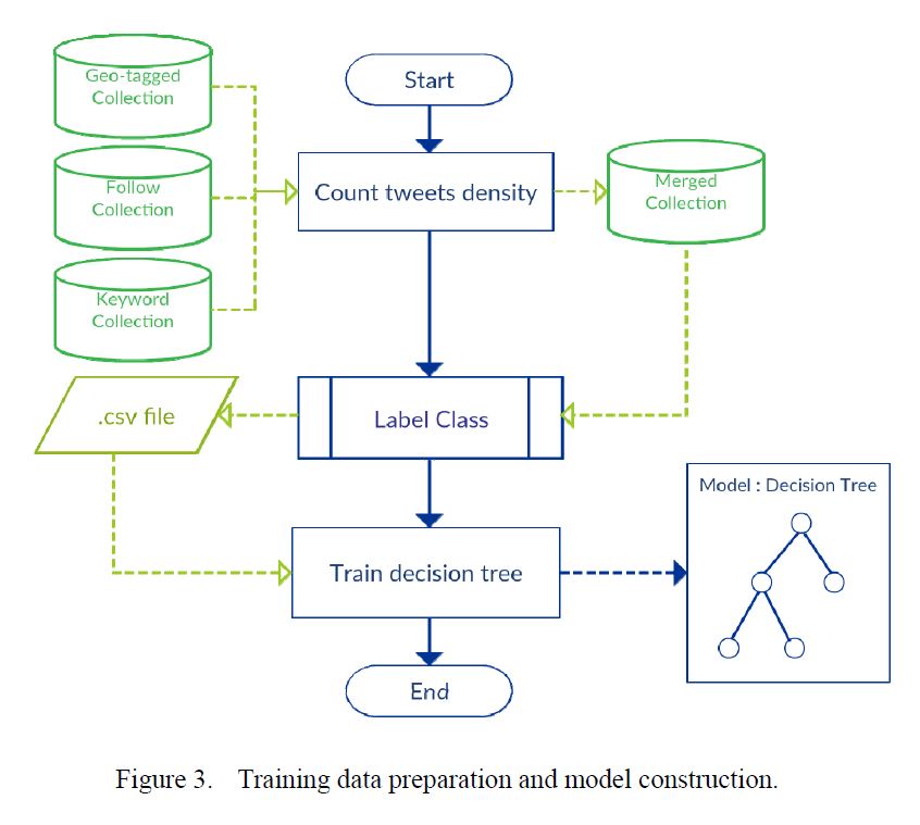
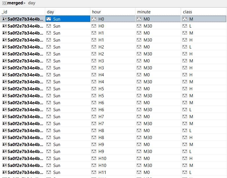
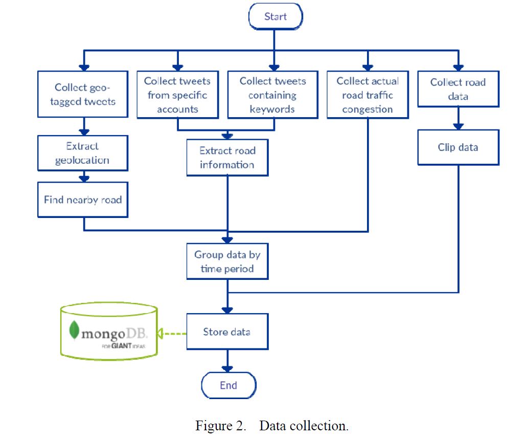
This is a Twitter based Vehicle Traffic mapper. Weka, twython, csv are used. The UI is a result of Google maps, Longdo aand Traffic Thailand apI. HTML, Javascript, CSS were the languages used. The goal was to append real life traffic, in interval of 30 minutes with the plot we mapped and that by taking weighted average of Tweets from relevant channels, users and searching using keywords in twitter(traffic, stuck, jam, pahonyothin rd.).Our target was Pahonyothin highway in Thailand it streches miles and is mostly crowded with vehicles. Moreover, people in Thailand are active tweeters and Longdo helped us most in giving wide set of ranges of data with plentiful agility and parameters. At last, 2 maps were compared side by side and their accurarcy were calculated, it was around 97%. This project was governed by a research paper we had from a university in south east asia.