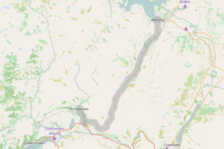
Renders a polyline with width fixed in meters, not in pixels. This means that the line width changes whenever zoom level changes. Handy to denote geographic corridors: ranges of specified width around a polyline.
Tested with Leaflet 0.7.1 or newer
Using leaflet-corridor plugin is very easy.
- Download and place the
leaflet-corridor.jsfile in your project. - Link javascript file in your HTML document:
<script src="...path-to-files.../leaflet-corridor.js"></script>- Then use in simple way in javascript file:
// Create polyline coordinates
var coords = [
  L.latLng(-44.696476, 169.13693),
  L.latLng(-44.69764, 169.134602)
  // ...
];

// Define corridor options including width
var options = {
  corridor: 1000, // meters
  className: 'route-corridor'
};

// Create a corridor and add to the map
var corridor = L.corridor(coords, options);
map.fitBounds(corridor.getBounds());
map.addLayer(corridor);| Parameter | Description |
|---|---|
| latlngs | Array of L.latLng to define polyline coordinates |
| options.corridor | Width of the corridor in meters |
| options.* | Options for polyline rendering, exactly same as in L.polyline |
leaflet-corridor is free software, and may be redistributed under the MIT-LICENSE.